






Method for Assessing the Regional Impact of Urban Lighting Using Satellite Nighttime Imagery
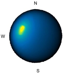
A solution has been developed that, for the first time, allows satellite night images to quantify the proportion of light emitted by cities just above the horizon, i.e. in a direction that allows light pollution to spread far beyond the borders of urban areas. Previous satellite systems have not been able to reliably detect this type of emission, as light at low elevations is outside their detection range. The method analyzes diffuse light halos around cities and compares the glow in front of and behind the city border, while not requiring a detailed inventory of all light sources in the city to determine the directional distribution of light. This is the first systematic solution for identifying the most problematic locations, which allows for more effective planning of measures to reduce light smog with an impact on ecosystems and the night sky.
Results of this research were published in Journal of Geophysical Researches – Atmosphere.